
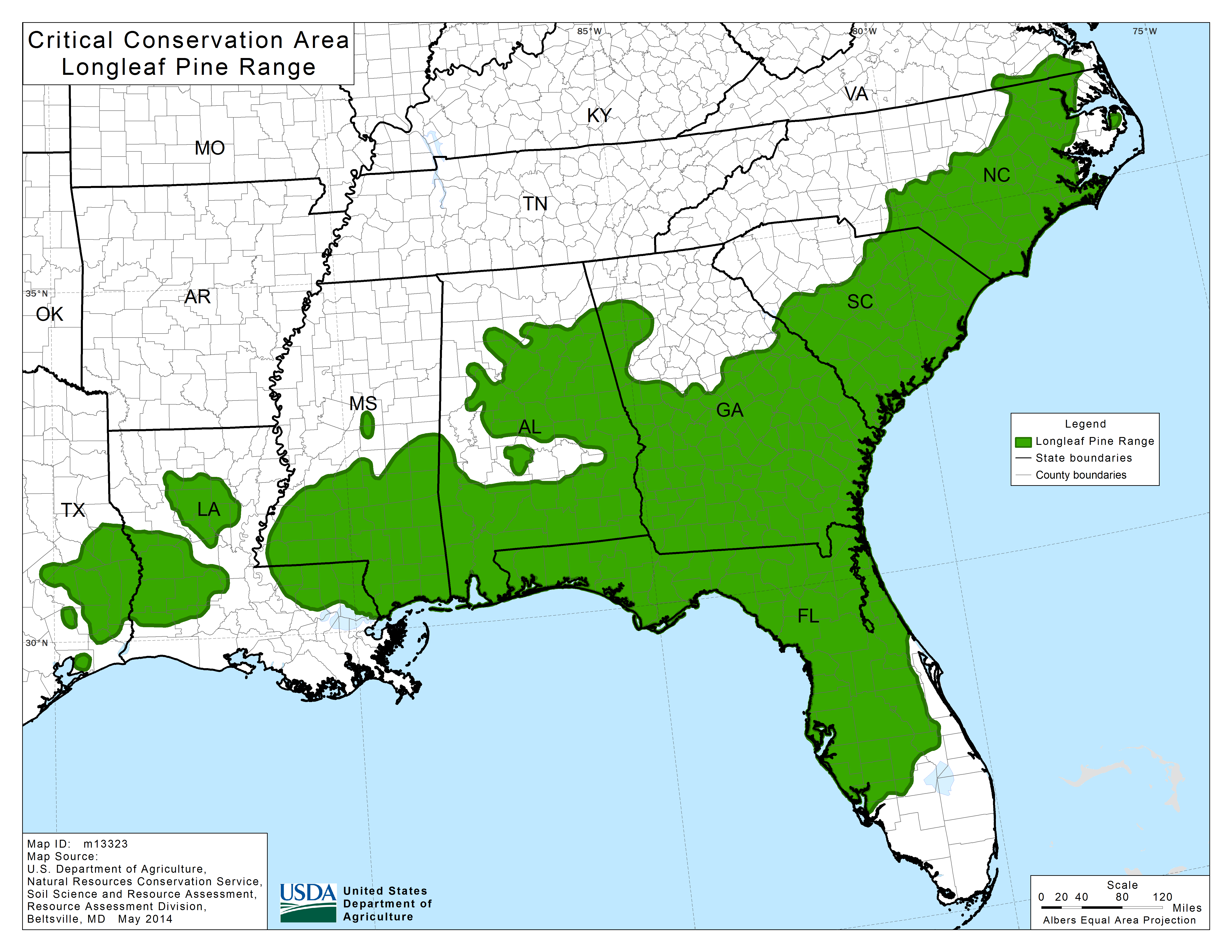
Southeast Longleaf Pine Database
The Southeast Longleaf Ecosystems Occurrences Geodatabase (LEO GDB) is a project to develop a comprehensive map database of documented longleaf pine locations and ecological conditions across the range. Florida Natural Areas Inventory (FNAI) worked in partnership with the Longleaf Alliance to build the LEO GDB with funding from Natural Resources Conservation Service(NRCS) via the U.S. Endowment for Forestry and Communities, and in close conjunction with the America's Longleaf Restoration Initiative - Longleaf Partnership Council, and other partners. This range-wide effort is modeled after the Florida Longleaf Pine Geodatabase , created by the Florida Forest Service and FNAI, which houses data for almost 2 million acres of existing longleaf pine in Florida. The LEO GDB enables partners to track longleaf acres and condition, and will be useful in conservation and cost-share planning efforts at the LIT level and regionally. The LEO GDB also informs the Longleaf Sustainability Analysis (LSA). Learn more about the LSA.
The LEO GDB v2.0 is now available to ALRI Partners. See the links below for the LEO Phase 2 Final Report, quick summary, and data license. To access the LEO GDB data, Web Map and LSA please fill out and return the LEO GDB and LSA License Agreement to the LEO Data Steward (email).
Project Objectives
- Design a spatial database to integrate existing longleaf pine occurrence and condition data from multiple sources, including new ground-truth data collected for the project
- Solicit and coalesce existing longleaf pine data from partners across the range
- Identify data gaps and develop prioritized polygons for field assessment in longleaf Local Implementation Team (LIT) areas
- Develop a field data collection protocol, a mobile data collection app, and training guide for field staff
- Develop a Web Map application for interactive query and display of data
Links
LIT Summaries for LEO GDB v1.2
A collection of LEO acreage summaries for 14 LITs. Select an area with the boxes and click the "Show Report" button to view a pdf for the LIT.