Longleaf Pine Sustainability Analysis
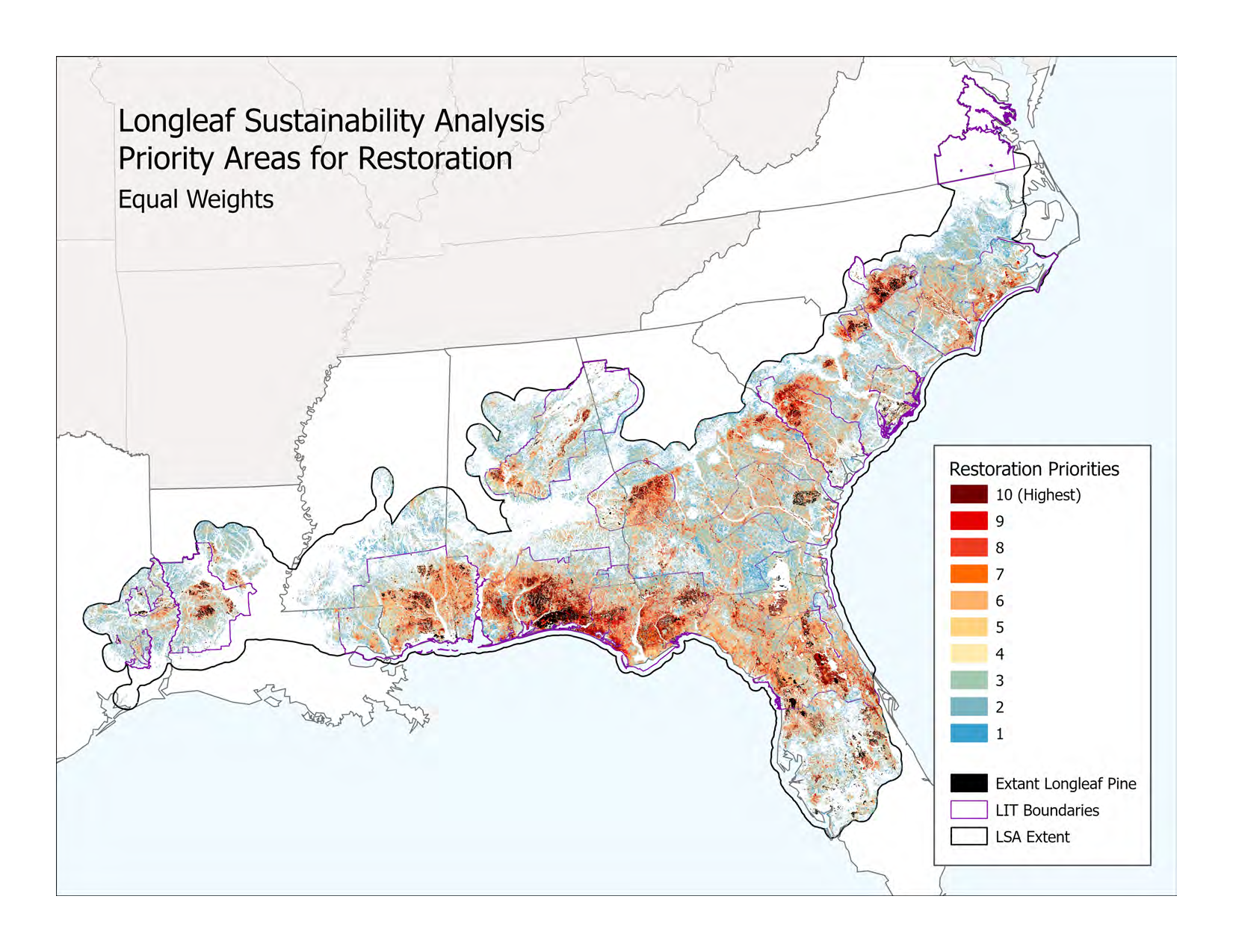
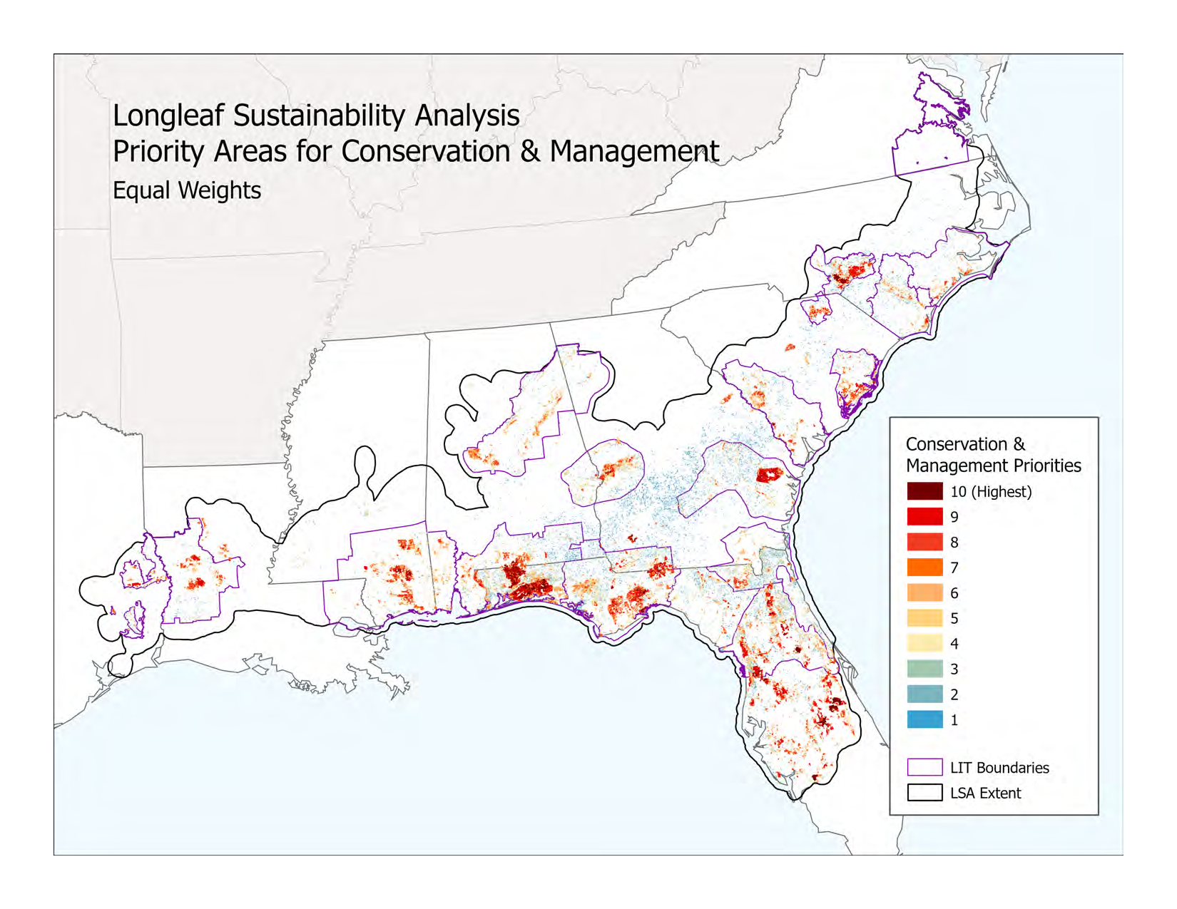
The Longleaf Sustainability Analysis (LSA) is a longleaf ecosystem-centric map analysis designed to facilitate the strategic, transparent, and evidence-based identification of the "right work" in the "right places" across the historic range of longleaf pine. The LSA combines map data about extant longleaf, suitable sites for restoration, landscape connectivity and other factors related to sustainability to prioritize areas on the landscape for implementation of restoration and conservation actions. The resulting priority maps are intended to support the objectives of America’s Longleaf Restoration Initiative’s (ALRI) Range-Wide Conservation Plan and other conservation work for the next 15 years.
The LSA v.1, completed in summer 2023, was developed by Florida Natural Areas Inventory (FNAI) and University of Florida-Center for Landscape Conservation Planning (UF-CLCP) with funding from USDA-NRCS through The Longleaf Alliance and U.S. Endowment for Forestry and Communities. The LSA is informed by the SE Longleaf Occurrences Geodatabase (LEO GDB), a project to develop a comprehensive map database of documented longleaf pine locations and ecological conditions across the range. Data for both the LSA and LEO are available to ALRI Partners under the same privacy policy and license agreement. Learn more about the LEO GDB here.
See the links below for the LSA Version 1 Technical Report, LSA Summary, and data license. To access the LSA and LEO GDB data please fill out and return the LEO GDB and LSA License Agreement to the LEO Data Steward (email).